


NEW YORK, December 27, 2025 – A powerful and disruptive winter storm is lashing the Northeastern United States, bringing treacherous blizzard conditions, widespread travel chaos, and prompting governors to declare states of emergency. The storm, arriving in the critical window between Christmas and New Year’s, is disrupting the plans of millions, stranding travelers, and making roadways impassable across the region.
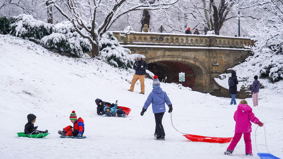
The system has delivered a one-two punch of heavy snow and ice, with whiteout conditions reported from Pennsylvania through New England. Major metropolitan areas, including the often more temperate New York City, are facing one of their most significant snowfalls in years. The storm’s timing during a peak holiday travel period has maximized its disruptive impact, overwhelming road crews and crippling major airport hubs.
In response to the extreme conditions, New York Governor Kathy Hochul and New Jersey’s governor have issued formal states of emergency. “Please continue to monitor your local forecast, avoid unnecessary travel and if you must travel, take all necessary precautions to ensure you arrive safely,” Hochul urged in an official statement, mobilizing state resources to assist in the response.
Read More:Injured officer who foiled suicide attempt at Islam’s holiest site identified,

Latest Forecast and Conditions
New York City Metro: Forecast to receive 6 to 8 inches of accumulation, with higher totals possible in northern suburbs. A Winter Storm Warning remains in effect.- Northern New Jersey & Hudson Valley: Expecting 8 to 12 inches of heavy, wet snow, creating hazardous driving conditions and the potential for downed tree branches and power lines.
- Upstate New York & New England: The hardest-hit areas are seeing blizzard conditions with 12 to 18+ inches of snow and wind gusts over 40 mph, causing near-zero visibility.
- Timeline: The heaviest snow fell overnight Friday into Saturday morning. While snow will taper off through Saturday, brutally cold temperatures and gusty winds will lead to significant blowing and drifting snow, hampering cleanup efforts.
Travel Impact Breakdown
The storm has caused a staggering domino effect across the nation’s transportation networks:
- Aviation Crisis: Nationwide, over 1,500 flights were canceled on Friday, with a further 500+ preemptively canceled for Saturday. Major hubs including John F. Kennedy (JFK), LaGuardia (LGA), Newark Liberty (EWR), and Philadelphia International (PHL) experienced the highest concentration of disruptions. Airlines are advising passengers not to travel to airports without a confirmed flight status.
- Roadway Nightmare: Interstate travel has become extremely dangerous. Multiple accidents and jackknifed tractor-trailers have been reported on critical arteries like I-95, I-87, and I-84. State transportation departments have issued full commercial vehicle bans on several highways. Officials repeat: “If you don’t have to be on the road, stay home.”
- Public Transit Delays: Major public transit systems, including New York City’s MTA, are operating with significant delays and service changes on above-ground subway lines and commuter rails like Metro-North and Long Island Rail Road.
Frequently Asked Questions
I have a flight scheduled for today or tomorrow. What should I do?
Do not go to the airport without confirming your flight. First, check your flight status directly via your airline’s website or app. Most major carriers (Delta, American, United, JetBlue) have issued travel waivers for the Northeast, allowing you to rebook without change fees for flights within a specific date range. Expect long hold times if calling.
What does a “state of emergency” mean for residents?
This declaration allows state governments to mobilize the National Guard if needed, access federal disaster funds, and implement driving bans or restrictions. For the public, it is the strongest possible signal to avoid all non-essential travel to keep roads clear for first responders and emergency crews.
How much snow will my area get, and when will it end?
Snow totals vary dramatically. While NYC may see 6-8″, areas just 50 miles north could see over a foot. The main snow band has moved through, but gusty winds will continue through Saturday, causing blowing snow and dangerous wind chills. Refer to the National Weather Service for the most precise, hyper-local forecast.
What are the essential items for a winter car emergency kit?
If travel is absolutely unavoidable, your vehicle should contain:
- A full tank of gas, blankets, warm clothing, and non-perishable snacks/water.
- A flashlight, batteries, a first-aid kit, and a portable phone charger.
- Jumper cables, an ice scraper, a small shovel, and cat litter or sand for traction.
- Most importantly: a charged cell phone to call for help if stranded.
When will conditions improve for travel?
While snow will stop falling by Saturday afternoon, the recovery will be slow. Airline schedules will remain a mess through the weekend as aircraft and crews are out of position. Roads will remain slick and hazardous due to refreezing overnight. The safest course is to postpone travel until at least Sunday, December 28th.
Conclusion
This major winter storm has delivered a severe and timely reminder of the formidable power of nature to disrupt modern life. Its impact, magnified by the holiday travel surge, underscores the vulnerability of even the most robust infrastructure to extreme weather. While the immediate response focuses on public safety and emergency services, the storm’s aftermath will involve a lengthy and complex recovery for the region’s transportation networks, likely causing ripple effects across the country’s flight schedules for days.
